Heritage trail around old Church and Kingshill
Prepared by Cllr Phil Barclay and the Nailsea and District Local History Society
Basic trail: 1-1.5hrs Extended trail: 2hrs
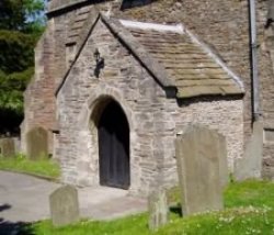
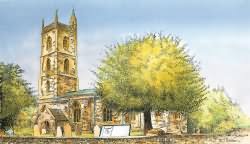
1. Start at Holy Trinity Church. Perpendicular in style and dating from the 15th century, the church has a tower typical of the area - although the pinnacles were not added until 1904. It houses a peal of six bells, one from the former Bristol Gaol. Note the South Porch with its pennant stone tiles alongside the socket and shaft of a medieval preaching cross. There were once two cottages on the roadside left of the entrance gates but these were demolished in 1894 to extend the churchyard. To the right look for the plaque which marks the position of the Parish Room demolished for road widening in 1963. Turn into Church Lane.
2. The Medieval Tithe Barn is on the corner. Note the low wall topped with clinker from local coal pits. By 1791 the far end contained two school rooms, the lower one belonging to Miss Hannah More.
3. Next door to the Tithe Barn is Glebe Cottage built for the schoolmaster and mistress. Continue along Church Lane past the churchyard until you come to the left and then right turns into the road.
4. Between these two turns in the road look out for Nile Cottage with its plaque commemorating Nelson's victory over Napoleon's fleet at the Battle of the Nile in 1798. In 1844 this cottage housed a private school. Continuing along Church Lane and cross Queens Road to Goss Lane and its junction with Union Street to your left.

Holy Trinity Church - South Porch
5. On the corner stands whitewashed 'Barwick' originally two small cottages. Proceed along Union Street - named after the Poors House or 'Union', once part of the present Yew Tree Cottage.
6. Look out for the Tall Cottage on the right. Built before 1750 as part of the Shallow Grove Coal Pit, the kitchen wall is incorporated into a deep shaft. Further along Union Street is
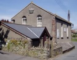
7. Ebenezer Primitive Methodist Chapel (1856-1964) now the Theatre Club but once an off-shoot of the 1792 chapel at Kingshill.
8. On the same side is the Old Colliery Cottage, once two dwellings, one the Colliers Arms beer house.
9. Located across the road where the public toilet now stand, were the lock up, stocks and whipping post on the village green.
10. Left into North Street and the 1750's cottages known as Kings Parade.
11. Opposite is Old Fire Station Court on the site of the 1934-1971 building and tower. (See extended trail at this point). Turn right down the unnamed lane and note at the bottom a white painted cottage behind the conifer hedge.
12. Here lived John and Mary Whiting, very early members of the Society of Friends (Quakers), who were imprisoned for their beliefs several times from 1679. The cottage believed to be the first Quaker Meeting House in North Somerset stands on the former village green which was bounded by North Street, Watery Lane (where you now stand) and Kingshill.
13. Tudor House on the corner of Watery Lane and Kingshill was the Bird in the Hand public house between 1902-1966. Look opposite and you will see.
14. Two modern houses. This site was the Tannery between 1696 and 1890. It supplied leather to a flourishing boot, clog and shoe cottage industry centred around Kingshill and Silver Street in the 1800s. Take a left turn along a track and public footpath around a high wall.
15. Here is Nailsea House. You can see through the gates one of the milestones excavated from the Tannery. Walk a few yards on and
16. Look through the gates of Old Kingshill Court - you can just see the chimney and white gable wall of Old Kingshill Farm House beyond the trees. When its thatched roof was replaced a receipt was found possibly indicating that some of Cromwell's Commonwealth Troops lodged here in 1643. Retrace your steps to Kingshill and cross the road. Look out for a footpath alongside No.18.
17. On this corner was the Poors House used as such until 1871.
18. Continue down the footpath, past the site of Kinghill Pit (c.1800-1820) and into Chapel Barton.

Ebenezer Primitive Methodist Chapel
now the Theatre Club
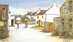
19. Opposite is reputedly the first Wesleyan Methodist Chapel in North Somerset built in 1792. Now extended as the Nailsea Social Club, much of its early congregation here drawn from the families of coal miners and glassworkers. Turn right until you get to the
20. Moorend Spout Public House (formerly the Butchers Arms c.1735). If you wish to extend your walk at this point see * at the end otherwise return along Union Street. Along the way look out for
21. Early Council Houses named Forty Fathoms after the coal pit which operated here until 1830.
*The Extended Walk
This route will take you along unmade footpaths and suitable footwear is recommended. From the Moorend Spout Public House continue along North Street and turn right into Fir Leaze, then left into North Lane. Note the tall cottage which was converted from a colliery engine house. Turn left at the Public Footpath sign and follow the public right of way through the garden of No.8 respecting the owner's privacy. Continue through the orchard keeping to the conifer hedge and cross the Parish Brook via the stone style. Follow the brook to the right to emerge on The Causeway. Note the long, narrow strip of land to your left, purchased for a canal to serve the coal mines and glass works but never built. Causeway House on your left and take the public footpath on the right skirting the edge of the stables. Cross the brook via the stile and then via a further field to another stile and Causeway View. Cross over the road and continue via the footpath to rejoin the shorter trail at Old Kingshill Court and Nailsea House.
To download a pdf version of the walk, which you can print, please click HERE


